Important notices
Nashwaak River, Lower Saint John — Fishing restrictions
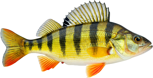
| Season / Restrictions | Bag Limit | Minimum Size | Maximum Size |
|---|---|---|---|
| April 15 – September 15 Rivers, brooks and streams | 5 | 10cm | N/A |
| Exceptions | |||
| June 16 – December 31 Rivers, brooks and streams from the Highway 107 Bridge in Nashwaak Bridge, downstream to a straight line drawn across the river from a point on the left side of the river (46° 14' 17.68" N, 66° 36' 45.31" W) to a point on the right side of the river (46° 14' 17.47" N, 66° 36' 41.44" W) including the waters of Young's Brook (McKenzie Brook) downstream from the Sentinel Trail bridge crossing | Closed to angling after June 15 | ||
| June 16 – December 31 Rivers, brooks and streams from a point 150 m downstream of Porters Brook to a point 30 m upstream of Porters Brook | Closed to angling after June 15 | ||
| June 16 – December 31 Rivers, brooks and streams Big Basin Pool (grid reference 4962899) | Closed to angling after June 15 | ||
| July 1 – December 31 Fly Fishing in rivers, brooks and streams upstream from the highway bridge at Penniac to the East Branch Nashwaak River | Fly fishing only beginning July 1 | ||
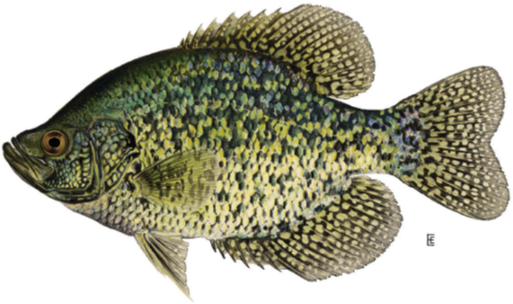
| Season / Restrictions | Bag Limit | Minimum Size | Maximum Size |
|---|---|---|---|
| April 15 – September 15 Rivers, brooks and streams | 2 | 15cm | N/A |
| Exceptions | |||
| June 16 – December 31 Rivers, brooks and streams from the Highway 107 Bridge in Nashwaak Bridge, downstream to a straight line drawn across the river from a point on the left side of the river (46° 14' 17.68" N, 66° 36' 45.31" W) to a point on the right side of the river (46° 14' 17.47" N, 66° 36' 41.44" W) including the waters of Young's Brook (McKenzie Brook) downstream from the Sentinel Trail bridge crossing | Closed to angling after June 15 | ||
| June 16 – December 31 Rivers, brooks and streams from a point 150 m downstream of Porters Brook to a point 30 m upstream of Porters Brook | Closed to angling after June 15 | ||
| June 16 – December 31 Rivers, brooks and streams Big Basin Pool (grid reference 4962899) | Closed to angling after June 15 | ||
| July 1 – December 31 Fly Fishing in rivers, brooks and streams upstream from the highway bridge at Penniac to the East Branch Nashwaak River | Fly fishing only beginning July 1 | ||
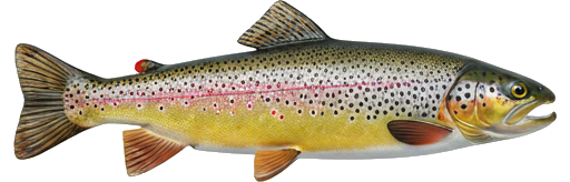
| Season / Restrictions | Bag Limit | Minimum Size | Maximum Size |
|---|---|---|---|
| January 1 – December 31 Non-tidal waters | 10 | 10cm | 100cm |
| January 1 – December 30 Tidal waters | 10 | 10cm | 100cm |
| Exceptions | |||
| June 16 – December 31 Rivers, brooks and streams from the Highway 107 Bridge in Nashwaak Bridge, downstream to a straight line drawn across the river from a point on the left side of the river (46° 14' 17.68" N, 66° 36' 45.31" W) to a point on the right side of the river (46° 14' 17.47" N, 66° 36' 41.44" W) including the waters of Young's Brook (McKenzie Brook) downstream from the Sentinel Trail bridge crossing | Closed to angling after June 15 | ||
| June 16 – December 31 Rivers, brooks and streams from a point 150 m downstream of Porters Brook to a point 30 m upstream of Porters Brook | Closed to angling after June 15 | ||
| June 16 – December 31 Rivers, brooks and streams Big Basin Pool (grid reference 4962899) | Closed to angling after June 15 | ||
| July 1 – December 31 Fly Fishing in rivers, brooks and streams upstream from the highway bridge at Penniac to the East Branch Nashwaak River | Fly fishing only beginning July 1 | ||
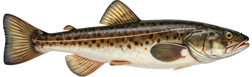
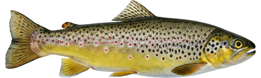
| Season / Restrictions | Bag Limit | Minimum Size | Maximum Size |
|---|---|---|---|
| January 1 – December 31 Non-tidal waters | 10 | 10cm | 100cm |
| January 1 – December 30 Tidal waters | 10 | 10cm | 100cm |
| Exceptions | |||
| June 16 – December 31 Rivers, brooks and streams from the Highway 107 Bridge in Nashwaak Bridge, downstream to a straight line drawn across the river from a point on the left side of the river (46° 14' 17.68" N, 66° 36' 45.31" W) to a point on the right side of the river (46° 14' 17.47" N, 66° 36' 41.44" W) including the waters of Young's Brook (McKenzie Brook) downstream from the Sentinel Trail bridge crossing | Closed to angling after June 15 | ||
| June 16 – December 31 Rivers, brooks and streams from a point 150 m downstream of Porters Brook to a point 30 m upstream of Porters Brook | Closed to angling after June 15 | ||
| June 16 – December 31 Rivers, brooks and streams Big Basin Pool (grid reference 4962899) | Closed to angling after June 15 | ||
| July 1 – December 31 Fly Fishing in rivers, brooks and streams upstream from the highway bridge at Penniac to the East Branch Nashwaak River | Fly fishing only beginning July 1 | ||
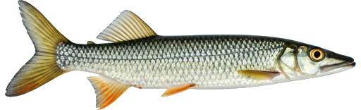
| Season / Restrictions | Bag Limit | Minimum Size | Maximum Size |
|---|---|---|---|
| January 1 – December 31 Non-tidal waters | 10 | 35cm | N/A |
| January 1 – December 31 Tidal waters | 10 | 35cm | N/A |
| Exceptions | |||
| June 16 – December 31 Rivers, brooks and streams from the Highway 107 Bridge in Nashwaak Bridge, downstream to a straight line drawn across the river from a point on the left side of the river (46° 14' 17.68" N, 66° 36' 45.31" W) to a point on the right side of the river (46° 14' 17.47" N, 66° 36' 41.44" W) including the waters of Young's Brook (McKenzie Brook) downstream from the Sentinel Trail bridge crossing | Closed to angling after June 15 | ||
| June 16 – December 31 Rivers, brooks and streams from a point 150 m downstream of Porters Brook to a point 30 m upstream of Porters Brook | Closed to angling after June 15 | ||
| June 16 – December 31 Rivers, brooks and streams Big Basin Pool (grid reference 4962899) | Closed to angling after June 15 | ||
| July 1 – December 31 Fly Fishing in rivers, brooks and streams upstream from the highway bridge at Penniac to the East Branch Nashwaak River | Fly fishing only beginning July 1 | ||
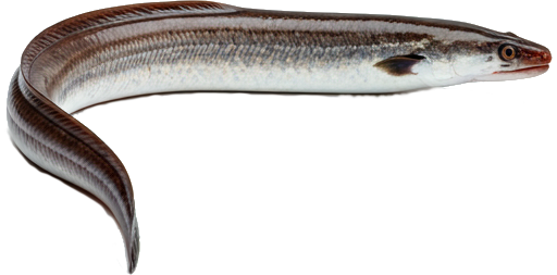
| Season / Restrictions | Bag Limit | Minimum Size | Maximum Size |
|---|---|---|---|
| January 1 – December 31 Non-tidal waters | 20 | N/A | N/A |
| January 1 – December 31 Tidal waters | 20 | N/A | N/A |
| Exceptions | |||
| June 16 – December 31 Rivers, brooks and streams from the Highway 107 Bridge in Nashwaak Bridge, downstream to a straight line drawn across the river from a point on the left side of the river (46° 14' 17.68" N, 66° 36' 45.31" W) to a point on the right side of the river (46° 14' 17.47" N, 66° 36' 41.44" W) including the waters of Young's Brook (McKenzie Brook) downstream from the Sentinel Trail bridge crossing | Closed to angling after June 15 | ||
| June 16 – December 31 Rivers, brooks and streams from a point 150 m downstream of Porters Brook to a point 30 m upstream of Porters Brook | Closed to angling after June 15 | ||
| June 16 – December 31 Rivers, brooks and streams Big Basin Pool (grid reference 4962899) | Closed to angling after June 15 | ||
| July 1 – December 31 Fly Fishing in rivers, brooks and streams upstream from the highway bridge at Penniac to the East Branch Nashwaak River | Fly fishing only beginning July 1 | ||
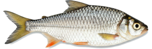
| Season / Restrictions | Bag Limit | Minimum Size | Maximum Size |
|---|---|---|---|
| April 15 – September 15 Rivers, brooks and streams | 2 | 45cm | N/A |
| Exceptions | |||
| June 16 – December 31 Rivers, brooks and streams from the Highway 107 Bridge in Nashwaak Bridge, downstream to a straight line drawn across the river from a point on the left side of the river (46° 14' 17.68" N, 66° 36' 45.31" W) to a point on the right side of the river (46° 14' 17.47" N, 66° 36' 41.44" W) including the waters of Young's Brook (McKenzie Brook) downstream from the Sentinel Trail bridge crossing | Closed to angling after June 15 | ||
| June 16 – December 31 Rivers, brooks and streams from a point 150 m downstream of Porters Brook to a point 30 m upstream of Porters Brook | Closed to angling after June 15 | ||
| June 16 – December 31 Rivers, brooks and streams Big Basin Pool (grid reference 4962899) | Closed to angling after June 15 | ||
| July 1 – December 31 Fly Fishing in rivers, brooks and streams upstream from the highway bridge at Penniac to the East Branch Nashwaak River | Fly fishing only beginning July 1 | ||
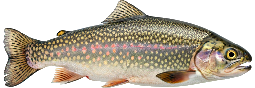
| Season / Restrictions | Bag Limit | Minimum Size | Maximum Size |
|---|---|---|---|
| January 1 – December 31 Non-tidal waters | 5 | 10cm | 170cm |
| January 1 – December 30 Tidal waters | 5 | 10cm | 170cm |
| Exceptions | |||
| June 16 – December 31 Rivers, brooks and streams from the Highway 107 Bridge in Nashwaak Bridge, downstream to a straight line drawn across the river from a point on the left side of the river (46° 14' 17.68" N, 66° 36' 45.31" W) to a point on the right side of the river (46° 14' 17.47" N, 66° 36' 41.44" W) including the waters of Young's Brook (McKenzie Brook) downstream from the Sentinel Trail bridge crossing | Closed to angling after June 15 | ||
| June 16 – December 31 Rivers, brooks and streams from a point 150 m downstream of Porters Brook to a point 30 m upstream of Porters Brook | Closed to angling after June 15 | ||
| June 16 – December 31 Rivers, brooks and streams Big Basin Pool (grid reference 4962899) | Closed to angling after June 15 | ||
| July 1 – December 31 Fly Fishing in rivers, brooks and streams upstream from the highway bridge at Penniac to the East Branch Nashwaak River | Fly fishing only beginning July 1 | ||
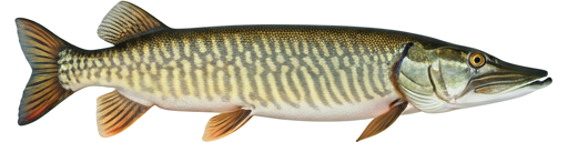
| Season / Restrictions | Bag Limit | Minimum Size | Maximum Size |
|---|---|---|---|
| January 1 – May 31 Dip Net in non-tidal waters | 60 | N/A | N/A |
| January 1 – September 30 Non-tidal waters | 60 | N/A | N/A |
| August 1 – May 31 Tidal waters | 60 | N/A | N/A |
| April 1 – May 31 Dip Net in tidal waters | 60 | N/A | N/A |
| Exceptions | |||
| June 16 – December 31 Rivers, brooks and streams from the Highway 107 Bridge in Nashwaak Bridge, downstream to a straight line drawn across the river from a point on the left side of the river (46° 14' 17.68" N, 66° 36' 45.31" W) to a point on the right side of the river (46° 14' 17.47" N, 66° 36' 41.44" W) including the waters of Young's Brook (McKenzie Brook) downstream from the Sentinel Trail bridge crossing | Closed to angling after June 15 | ||
| June 16 – December 31 Rivers, brooks and streams from a point 150 m downstream of Porters Brook to a point 30 m upstream of Porters Brook | Closed to angling after June 15 | ||
| June 16 – December 31 Rivers, brooks and streams Big Basin Pool (grid reference 4962899) | Closed to angling after June 15 | ||
| July 1 – December 31 Fly Fishing in rivers, brooks and streams upstream from the highway bridge at Penniac to the East Branch Nashwaak River | Fly fishing only beginning July 1 | ||
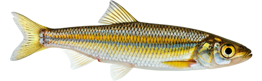
| Season / Restrictions | Bag Limit | Minimum Size | Maximum Size |
|---|---|---|---|
| April 15 – September 15 Rivers, brooks and streams | 5 | 15cm | N/A |
| Exceptions | |||
| June 16 – December 31 Rivers, brooks and streams from the Highway 107 Bridge in Nashwaak Bridge, downstream to a straight line drawn across the river from a point on the left side of the river (46° 14' 17.68" N, 66° 36' 45.31" W) to a point on the right side of the river (46° 14' 17.47" N, 66° 36' 41.44" W) including the waters of Young's Brook (McKenzie Brook) downstream from the Sentinel Trail bridge crossing | Closed to angling after June 15 | ||
| June 16 – December 31 Rivers, brooks and streams from a point 150 m downstream of Porters Brook to a point 30 m upstream of Porters Brook | Closed to angling after June 15 | ||
| June 16 – December 31 Rivers, brooks and streams Big Basin Pool (grid reference 4962899) | Closed to angling after June 15 | ||
| July 1 – December 31 Fly Fishing in rivers, brooks and streams upstream from the highway bridge at Penniac to the East Branch Nashwaak River | Fly fishing only beginning July 1 | ||
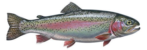
| Season / Restrictions | Bag Limit | Minimum Size | Maximum Size |
|---|---|---|---|
| January 1 – December 31 Non-tidal waters | 5 | N/A | N/A |
| January 1 – December 31 Tidal waters | 5 | N/A | N/A |
| Exceptions | |||
| June 16 – December 31 Rivers, brooks and streams from the Highway 107 Bridge in Nashwaak Bridge, downstream to a straight line drawn across the river from a point on the left side of the river (46° 14' 17.68" N, 66° 36' 45.31" W) to a point on the right side of the river (46° 14' 17.47" N, 66° 36' 41.44" W) including the waters of Young's Brook (McKenzie Brook) downstream from the Sentinel Trail bridge crossing | Closed to angling after June 15 | ||
| June 16 – December 31 Rivers, brooks and streams from a point 150 m downstream of Porters Brook to a point 30 m upstream of Porters Brook | Closed to angling after June 15 | ||
| June 16 – December 31 Rivers, brooks and streams Big Basin Pool (grid reference 4962899) | Closed to angling after June 15 | ||
| July 1 – December 31 Fly Fishing in rivers, brooks and streams upstream from the highway bridge at Penniac to the East Branch Nashwaak River | Fly fishing only beginning July 1 | ||
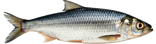
| Season / Restrictions | Bag Limit | Minimum Size | Maximum Size |
|---|---|---|---|
| April 15 – June 30 , | 0 | 30cm | 60cm |
| July 1 – September 15 , | 2 | 30cm | 60cm |
| September 16 – October 15 | 0 | 30cm | 60cm |
| Non-tidal portions of rivers, brooks and streams downstream of the Durham Bridge | |||
| April 15 – October 15 Rivers, brooks and streams from the Durham Bridge upstream to the East Branch Nashwaak River | 5 | 10cm | 60cm |
| Exceptions | |||
| June 16 – December 31 Rivers, brooks and streams from the Highway 107 Bridge in Nashwaak Bridge, downstream to a straight line drawn across the river from a point on the left side of the river (46° 14' 17.68" N, 66° 36' 45.31" W) to a point on the right side of the river (46° 14' 17.47" N, 66° 36' 41.44" W) including the waters of Young's Brook (McKenzie Brook) downstream from the Sentinel Trail bridge crossing | Closed to angling after June 15 | ||
| June 16 – December 31 Rivers, brooks and streams from a point 150 m downstream of Porters Brook to a point 30 m upstream of Porters Brook | Closed to angling after June 15 | ||
| June 16 – December 31 Rivers, brooks and streams Big Basin Pool (grid reference 4962899) | Closed to angling after June 15 | ||
| July 1 – December 31 Fly Fishing in rivers, brooks and streams upstream from the highway bridge at Penniac to the East Branch Nashwaak River | Fly fishing only beginning July 1 | ||
| April 15 – September 15 Rivers, brooks and streams | 5 | 10cm | 60cm |
| Exceptions | |||
| June 16 – December 31 Rivers, brooks and streams from the Highway 107 Bridge in Nashwaak Bridge, downstream to a straight line drawn across the river from a point on the left side of the river (46° 14' 17.68" N, 66° 36' 45.31" W) to a point on the right side of the river (46° 14' 17.47" N, 66° 36' 41.44" W) including the waters of Young's Brook (McKenzie Brook) downstream from the Sentinel Trail bridge crossing | Closed to angling after June 15 | ||
| June 16 – December 31 Rivers, brooks and streams from a point 150 m downstream of Porters Brook to a point 30 m upstream of Porters Brook | Closed to angling after June 15 | ||
| June 16 – December 31 Rivers, brooks and streams Big Basin Pool (grid reference 4962899) | Closed to angling after June 15 | ||
| July 1 – December 31 Fly Fishing in rivers, brooks and streams upstream from the highway bridge at Penniac to the East Branch Nashwaak River | Fly fishing only beginning July 1 | ||
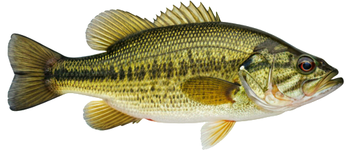
| Season / Restrictions | Bag Limit | Minimum Size | Maximum Size |
|---|---|---|---|
| January 1 – October 15 Non-tidal waters | 1 | 68cm | 150cm |
| January 1 – December 29 Tidal waters | 1 | 68cm | 150cm |
| Exceptions | |||
| June 16 – December 31 Rivers, brooks and streams from the Highway 107 Bridge in Nashwaak Bridge, downstream to a straight line drawn across the river from a point on the left side of the river (46° 14' 17.68" N, 66° 36' 45.31" W) to a point on the right side of the river (46° 14' 17.47" N, 66° 36' 41.44" W) including the waters of Young's Brook (McKenzie Brook) downstream from the Sentinel Trail bridge crossing | Closed to angling after June 15 | ||
| June 16 – December 31 Rivers, brooks and streams from a point 150 m downstream of Porters Brook to a point 30 m upstream of Porters Brook | Closed to angling after June 15 | ||
| June 16 – December 31 Rivers, brooks and streams Big Basin Pool (grid reference 4962899) | Closed to angling after June 15 | ||
| July 1 – December 31 Fly Fishing in rivers, brooks and streams upstream from the highway bridge at Penniac to the East Branch Nashwaak River | Fly fishing only beginning July 1 | ||
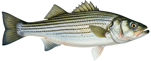
| Season / Restrictions | Bag Limit | Minimum Size | Maximum Size |
|---|---|---|---|
| January 1 – May 31 , | ∞ | 130cm | N/A |
| July 1 – December 31 | ∞ | 130cm | N/A |
| Fly Fishing in non-tidal waters ⚠ | |||
| January 1 – May 31 , | ∞ | 130cm | N/A |
| July 1 – December 31 | ∞ | 130cm | N/A |
| Fly Fishing in tidal waters ⚠ | |||
| Exceptions | |||
| June 16 – December 31 Rivers, brooks and streams from the Highway 107 Bridge in Nashwaak Bridge, downstream to a straight line drawn across the river from a point on the left side of the river (46° 14' 17.68" N, 66° 36' 45.31" W) to a point on the right side of the river (46° 14' 17.47" N, 66° 36' 41.44" W) including the waters of Young's Brook (McKenzie Brook) downstream from the Sentinel Trail bridge crossing | Closed to angling after June 15 | ||
| June 16 – December 31 Rivers, brooks and streams from a point 150 m downstream of Porters Brook to a point 30 m upstream of Porters Brook | Closed to angling after June 15 | ||
| June 16 – December 31 Rivers, brooks and streams Big Basin Pool (grid reference 4962899) | Closed to angling after June 15 | ||
| July 1 – December 31 Fly Fishing in rivers, brooks and streams upstream from the highway bridge at Penniac to the East Branch Nashwaak River | Fly fishing only beginning July 1 | ||
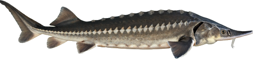
| Season / Restrictions | Bag Limit | Minimum Size | Maximum Size |
|---|---|---|---|
| January 1 – December 31 Non-tidal waters | 25 | 10cm | 50cm |
| January 1 – December 30 Tidal waters | 25 | 10cm | 50cm |
| Exceptions | |||
| June 16 – December 31 Rivers, brooks and streams from the Highway 107 Bridge in Nashwaak Bridge, downstream to a straight line drawn across the river from a point on the left side of the river (46° 14' 17.68" N, 66° 36' 45.31" W) to a point on the right side of the river (46° 14' 17.47" N, 66° 36' 41.44" W) including the waters of Young's Brook (McKenzie Brook) downstream from the Sentinel Trail bridge crossing | Closed to angling after June 15 | ||
| June 16 – December 31 Rivers, brooks and streams from a point 150 m downstream of Porters Brook to a point 30 m upstream of Porters Brook | Closed to angling after June 15 | ||
| June 16 – December 31 Rivers, brooks and streams Big Basin Pool (grid reference 4962899) | Closed to angling after June 15 | ||
| July 1 – December 31 Fly Fishing in rivers, brooks and streams upstream from the highway bridge at Penniac to the East Branch Nashwaak River | Fly fishing only beginning July 1 | ||
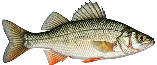
| Season / Restrictions | Bag Limit | Minimum Size | Maximum Size |
|---|---|---|---|
| January 1 – September 15 Non-tidal waters | 8 | 10cm | 70cm |
| January 1 – September 15 Tidal waters | 8 | 10cm | 70cm |
| Exceptions | |||
| June 16 – December 31 Rivers, brooks and streams from the Highway 107 Bridge in Nashwaak Bridge, downstream to a straight line drawn across the river from a point on the left side of the river (46° 14' 17.68" N, 66° 36' 45.31" W) to a point on the right side of the river (46° 14' 17.47" N, 66° 36' 41.44" W) including the waters of Young's Brook (McKenzie Brook) downstream from the Sentinel Trail bridge crossing | Closed to angling after June 15 | ||
| June 16 – December 31 Rivers, brooks and streams from a point 150 m downstream of Porters Brook to a point 30 m upstream of Porters Brook | Closed to angling after June 15 | ||
| June 16 – December 31 Rivers, brooks and streams Big Basin Pool (grid reference 4962899) | Closed to angling after June 15 | ||
| July 1 – December 31 Fly Fishing in rivers, brooks and streams upstream from the highway bridge at Penniac to the East Branch Nashwaak River | Fly fishing only beginning July 1 | ||
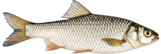
| Season / Restrictions | Bag Limit | Minimum Size | Maximum Size |
|---|---|---|---|
| January 1 – December 31 Non-tidal waters | 100 | 10cm | 50cm |
| January 1 – December 30 Tidal waters | 100 | 10cm | 50cm |
| Exceptions | |||
| June 16 – December 31 Rivers, brooks and streams from the Highway 107 Bridge in Nashwaak Bridge, downstream to a straight line drawn across the river from a point on the left side of the river (46° 14' 17.68" N, 66° 36' 45.31" W) to a point on the right side of the river (46° 14' 17.47" N, 66° 36' 41.44" W) including the waters of Young's Brook (McKenzie Brook) downstream from the Sentinel Trail bridge crossing | Closed to angling after June 15 | ||
| June 16 – December 31 Rivers, brooks and streams from a point 150 m downstream of Porters Brook to a point 30 m upstream of Porters Brook | Closed to angling after June 15 | ||
| June 16 – December 31 Rivers, brooks and streams Big Basin Pool (grid reference 4962899) | Closed to angling after June 15 | ||
| July 1 – December 31 Fly Fishing in rivers, brooks and streams upstream from the highway bridge at Penniac to the East Branch Nashwaak River | Fly fishing only beginning July 1 | ||